Pestschany (Sacha)
| Pestschany | ||||||
|---|---|---|---|---|---|---|
| Gewässer | Laptewsee | |||||
| Geographische Lage | 74° 18′ N, 116° 2′ O
{{#coordinates:74,308333333333|116,03333333333|primary
|
dim= | globe= | name=Pestschany | region=RU-SA | type=isle
}} |
|
| ||||||
| Anzahl der Inseln | 4 | |||||
| Hauptinsel | Pestschany | |||||
| Gesamte Landfläche | 17 km² | |||||
| Einwohner | unbewohnt | |||||
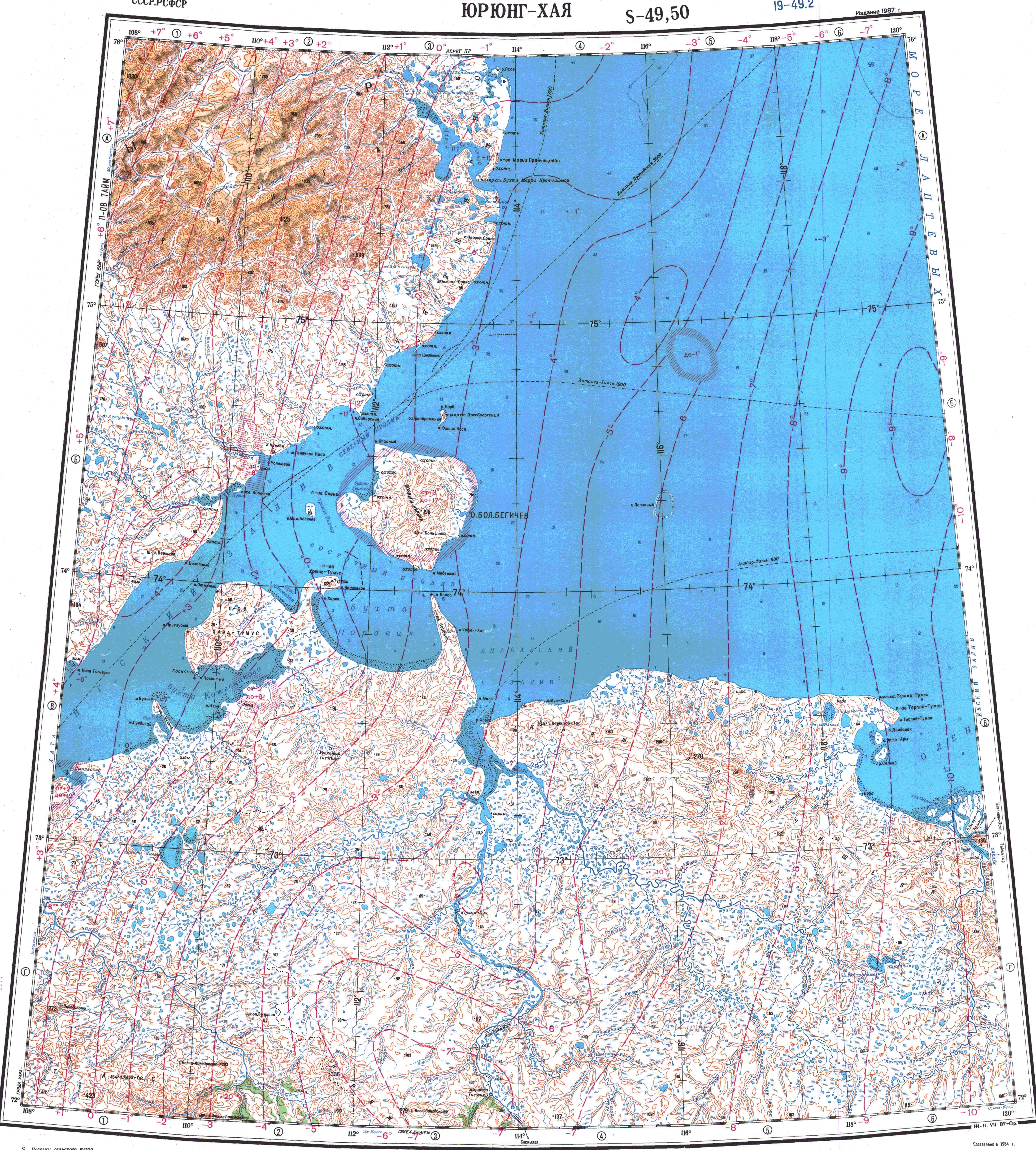
Pestschany ({{Modul:Vorlage:lang}} Modul:Vorlage:lang:103: attempt to index field 'wikibase' (a nil value); „Sandinsel“) ist eine unbewohnte, isoliert in der Laptewsee liegende Nehrung vor der Nordküste Russlands. Administrativ gehört sie zum Nationalulus (Rajon) Anabarski der Republik Sacha (Jakutien).
Pestschany liegt 74 Kilometer östlich der Insel Bolschoi Begitschew, 85 km östlich der Taimyr-Halbinsel sowie 62 km nördlich des jakutischen Festlands. Die 12 km lange, ungewöhnlich elliptisch geformte Nehrung ist im Osten unterbrochen, sodass sie aus insgesamt vier flachen, sandigen und vegetationslosen Inseln besteht, die eine rund 6 × 4 km große Lagune umringen. Im Aussehen ähnelt sie somit den tropischen Atollen.
Die Nehrung hat eine Breite zwischen 600 und 900 Metern. Bei einer Bogenlänge der elliptischen Nehrung von 23 Kilometern ergibt dies eine Landfläche von rund 17 km².
Im Winter gibt es im Festeis bei Pestschany regelmäßig eine große stationäre Polynja, die sich von der Mündung des Anabar nordwärts erstreckt.<ref></ref>
Die isolierte Insel Pestschany ist bekannt für ihre Kolonien von Walrossen. 1980 wurden hier zwei Herden mit 200 bzw. 397 Tieren beobachtet.<ref>J. W. Higdon, D. B. Stewart: State of circumpolar walrus populations (Odobenus rosmarus). Prepared by Higdon Wildlife Consulting and Arctic Biological Consultants, Winnipeg, Manitoba, for WWF Arctic Programme, Ottawa 2018, S. 28 (englisch, PDF).</ref>
Literatur
- G. Gilbo: Sprawotschnik po istorii geografitscheskich naswani na pobereschje SSSR. Ministerstwo oborony Soiusa SSR, Glaw. upr. nawigazii i okeanografii, 1985, S. 264. (russisch)
Einzelnachweise
<references />
Weblinks
- Topographische Karte (1:1.000.000, Bl. S-49-50, Ausg. 1987)
- Ein Foto von Pestschany