Puná
| Puná
| ||||||
|---|---|---|---|---|---|---|
mit Puná im Süden (unten) | ||||||
| Gewässer | Golf von Guayaquil | |||||
| Geographische Lage | 2° 50′ S, 80° 9′ W
{{#coordinates:−2,8375|−80,148055555556|primary
|
dim=51000 | globe= | name=Puná | region=EC-G | type=isle
}} |
|
| ||||||
| Länge | 51 km | |||||
| Breite | 26 km | |||||
| Fläche | 855 km² | |||||
| Höchste Erhebung | Zamba Palo 253 m | |||||
| Einwohner | 6500 (2001) 7,6 Einw./km² | |||||
| Hauptort | Puná | |||||
Norden ist rechts Norden ist rechts | ||||||
.svg)
Die Isla de Puná (Puná-Insel) ist eine 855 km² große Insel im Süden der Küste Ecuadors an der Mündung des Flusses Río Guayas in den Golf von Guayaquil des Pazifik. Sie liegt damit südlich der Hafenstadt Guayaquil zwischen dem minimal 10,3 km breiten Jambeli-Kanal und dem drei Kilometer breiten Morro-Kanal, die die Mündung des Guayas mit dem offenen Golf verbinden.
Verwaltung
Die Insel bildet eine Parroquia im Kanton Guayaquil der Provinz Guayas.
Geschichte
Im April 1531 fand auf der Insel eine Schlacht zwischen den spanischen Konquistadoren unter Francisco Pizarro und den einheimischen Tumbez statt. Die Tumbez hatten zuvor ihre Unabhängigkeit von den Inka gewahrt, was ihnen jedoch gegen die Spanier nicht gelang. Von seinem Feldlager<ref>Jean Descola: Les Conquistadors : La découverte et la conquête de l’Amérique latine (= Collection Texto). 2. Auflage. Éditions Tallandier, Paris 2020, ISBN 979-1-02104235-3, S. 389, 391.</ref> auf Puná aus gelangte Pizarro an das Festland und begann die Eroberung des Inkareiches. 1541 wurde auf Puná der Parteigänger Pizarros und Bischof von Peru (Cuzco), der Dominikaner Vicente de Valverde, von den Tumbez als Reaktion auf die Zerstörung ihrer Kultstätten ermordet und nach Chronistenberichten in einem kannibalischen Ritus verspeist. Seit 1557 wurde Puná zum Standort von Werften, die vor allem Galeonen herstellten und reparierten. Die Insel war im 16. und 17. Jahrhundert mehrfach Schauplatz von Kämpfen zwischen spanischen Truppen und Piraten.
Geographie
Die Insel hat etwa 6500 Einwohner (2001), die von Landwirtschaft, Fischerei und Mollusken-Sammeln leben. 94 % von ihnen werden als „arm“ eingestuft. Viele der natürlichen Mangroven auf der Insel wurden durch kommerzielle Garnelenzucht zerstört. Erste Projekte zu ihrer Renaturierung wurden begonnen.
Der gleichnamige Hauptort Puná liegt im Nordosten der Insel.
Sonstiges
Nach der Insel wurde 1963 das Typschiff der Kühlschiffe vom Typ Puná benannt.
Weblinks
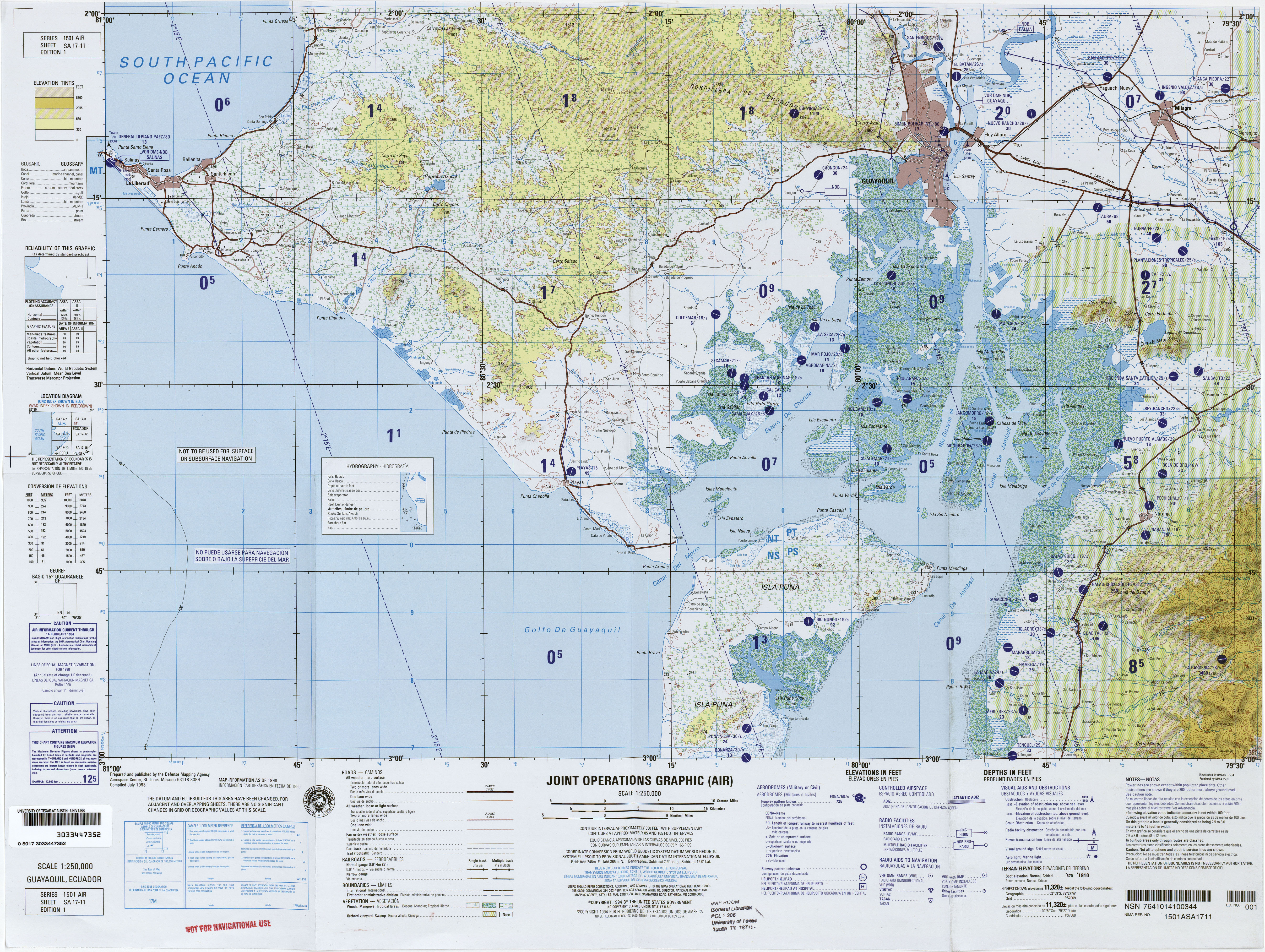
- Kartenblatt SA17-11 der Reihe Latin America, Joint Operations Graphic 1:250,000 (mit Großteil der Insel)
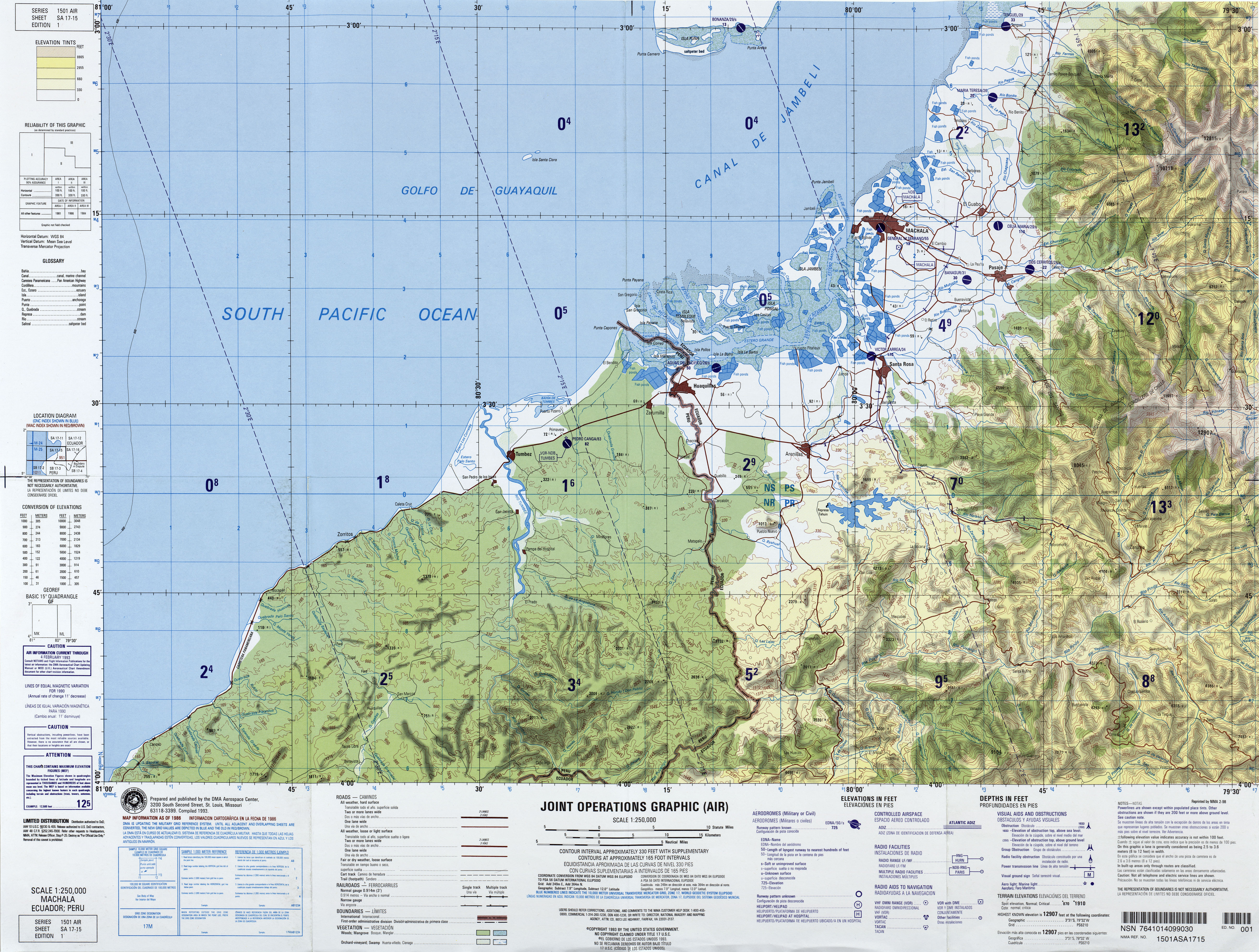
- Kartenblatt SA17-15 der Reihe Latin America, Joint Operations Graphic 1:250,000 (mit Südzipfel der Insel)
Einzelnachweise
<references />