Zum Inhalt springen

Bijol Islands

aus Wikipedia, der freien Enzyklopädie
{{#if: | {{#if: Atlantischer Ozean| {{#if: | {{#if:| }} }} }} {{#if: 5| {{#if: Bijol Island| {{#if: 0.1| {{#if: 0| {{#if: |
{{#if:|{{{Name}}}|{{#invoke:WLink|getArticleBase}}}}
[[Datei:|300px|zentriert|alt=|]]

}}

Gewässer Atlantischer Ozean|Atlantischer Ozean}} {{#if:651951 colspan="2" | Pflichtparameter GEWAESSER fehlt }}

}}

Archipel [[]]|}}

}}

1|1}}|{{#switch:{{Info ISO-3166-2:{{#titleparts:GM-W|1|1}}|level}} 1|2={{Info ISO-3166-2:{{#titleparts:GM-W|1|1}}|{{#switch:top 1|1}}|level}} adm2nd=2 adm1st=1 country=0 #default=top
 }}
}}
#default={{#switch: top continent = level = maxlevel = acronym = top = ?? upper = admtype = admtypelink = admname = lemma = 0 = 1 = 2 = map = Erde flag = Flag of None.svg

}} }}}}

LI|CH|GB={{#switch:{{#if:{{#titleparts:GM-W|1|2}}|{{#switch:{{Info ISO-3166-2:{{#titleparts:GM-W|1|2}}|level}} 1|2={{Info ISO-3166-2:{{#titleparts:GM-W|1|2}}|{{#switch:top 1|2}}|level}} adm2nd=2 adm1st=1 country=0 #default=top
 }}
}}
#default={{#switch: top continent = level = maxlevel = acronym = top = ?? upper = admtype = admtypelink = admname = lemma = 0 = 1 = 2 = map = Erde flag = Flag of None.svg

}} }}}}

LI|CH|GB={{#switch:{{#if:{{#titleparts:GM-W|1|3}}|{{#switch:{{Info ISO-3166-2:{{#titleparts:GM-W|1|3}}|level}} 1|2={{Info ISO-3166-2:{{#titleparts:GM-W|1|3}}|{{#switch:top 1|3}}|level}} adm2nd=2 adm1st=1 country=0 #default=top
 }}
}}
#default={{#switch: top continent = level = maxlevel = acronym = top = ?? upper = admtype = admtypelink = admname = lemma = 0 = 1 = 2 = map = Erde flag = Flag of None.svg

}} }}}}

CH|GB={{#switch:{{#if:{{#titleparts:GM-W|1|4}}|{{#switch:{{Info ISO-3166-2:{{#titleparts:GM-W|1|4}}|level}} 1|2={{Info ISO-3166-2:{{#titleparts:GM-W|1|4}}|{{#switch:top 1|4}}|level}} adm2nd=2 adm1st=1 country=0 #default=top
 }}
}}
#default={{#switch: top continent = level = maxlevel = acronym = top = ?? upper = admtype = admtypelink = admname = lemma = 0 = 1 = 2 = map = Erde flag = Flag of None.svg

}} }}}}||LI|CH|GB=|#default=DMS/}}

#default=DMS/}} #default=DMS/}} #default=DMS/}}{{#switch:CH 1|1}}|{{#switch:{{Info ISO-3166-2:{{#titleparts:GM-W|1|1}}|level}} 1|2={{Info ISO-3166-2:{{#titleparts:GM-W|1|1}}|{{#switch:top 1|1}}|level}} adm2nd=2 adm1st=1 country=0 #default=top
 }}
}}
#default={{#switch: top continent = level = maxlevel = acronym = top = ?? upper = admtype = admtypelink = admname = lemma = 0 = 1 = 2 = map = Erde flag = Flag of None.svg

}} }}}}

1|2}}|{{#switch:{{Info ISO-3166-2:{{#titleparts:GM-W|1|2}}|level}} 1|2={{Info ISO-3166-2:{{#titleparts:GM-W|1|2}}|{{#switch:top 1|2}}|level}} adm2nd=2 adm1st=1 country=0 #default=top
 }}
}}
#default={{#switch: top continent = level = maxlevel = acronym = top = ?? upper = admtype = admtypelink = admname = lemma = 0 = 1 = 2 = map = Erde flag = Flag of None.svg

}} }}}}

1|3}}|{{#switch:{{Info ISO-3166-2:{{#titleparts:GM-W|1|3}}|level}} 1|2={{Info ISO-3166-2:{{#titleparts:GM-W|1|3}}|{{#switch:top 1|3}}|level}} adm2nd=2 adm1st=1 country=0 #default=top
 }}
}}
#default={{#switch: top continent = level = maxlevel = acronym = top = ?? upper = admtype = admtypelink = admname = lemma = 0 = 1 = 2 = map = Erde flag = Flag of None.svg

}} }}}}

1|4}}|{{#switch:{{Info ISO-3166-2:{{#titleparts:GM-W|1|4}}|level}} 1|2={{Info ISO-3166-2:{{#titleparts:GM-W|1|4}}|{{#switch:top 1|4}}|level}} adm2nd=2 adm1st=1 country=0 #default=top
 }}
}}
#default={{#switch: top continent = level = maxlevel = acronym = top = ?? upper = admtype = admtypelink = admname = lemma = 0 = 1 = 2 = map = Erde flag = Flag of None.svg

}} }}}}=CH1903/CH1903

#default={{#switch:LI 1|1}}|{{#switch:{{Info ISO-3166-2:{{#titleparts:GM-W|1|1}}|level}} 1|2={{Info ISO-3166-2:{{#titleparts:GM-W|1|1}}|{{#switch:top 1|1}}|level}} adm2nd=2 adm1st=1 country=0 #default=top
 }}
}}
#default={{#switch: top continent = level = maxlevel = acronym = top = ?? upper = admtype = admtypelink = admname = lemma = 0 = 1 = 2 = map = Erde flag = Flag of None.svg

}} }}}}

1|2}}|{{#switch:{{Info ISO-3166-2:{{#titleparts:GM-W|1|2}}|level}} 1|2={{Info ISO-3166-2:{{#titleparts:GM-W|1|2}}|{{#switch:top 1|2}}|level}} adm2nd=2 adm1st=1 country=0 #default=top
 }}
}}
#default={{#switch: top continent = level = maxlevel = acronym = top = ?? upper = admtype = admtypelink = admname = lemma = 0 = 1 = 2 = map = Erde flag = Flag of None.svg

}} }}}}

1|3}}|{{#switch:{{Info ISO-3166-2:{{#titleparts:GM-W|1|3}}|level}} 1|2={{Info ISO-3166-2:{{#titleparts:GM-W|1|3}}|{{#switch:top 1|3}}|level}} adm2nd=2 adm1st=1 country=0 #default=top
 }}
}}
#default={{#switch: top continent = level = maxlevel = acronym = top = ?? upper = admtype = admtypelink = admname = lemma = 0 = 1 = 2 = map = Erde flag = Flag of None.svg

}} }}}}

1|4}}|{{#switch:{{Info ISO-3166-2:{{#titleparts:GM-W|1|4}}|level}} 1|2={{Info ISO-3166-2:{{#titleparts:GM-W|1|4}}|{{#switch:top 1|4}}|level}} adm2nd=2 adm1st=1 country=0 #default=top
 }}
}}
#default={{#switch: top continent = level = maxlevel = acronym = top = ?? upper = admtype = admtypelink = admname = lemma = 0 = 1 = 2 = map = Erde flag = Flag of None.svg

}} }}}}=CH1903/CH1903

#default=DMS/DMS

}}}}

DMS/CH1903/CH1903={{#if:Geographische Lage|Geographische Lage|Koordinaten}}, (CH) CH1903/CH1903={{#if:Geographische Lage|Geographische Lage|Koordinaten}} OSGB36/OSGB36=Ordnance Survey GB UTM=UTM-Koordinaten #default={{#if:Geographische Lage|Geographische Lage|Koordinaten}}

}}

y|Simple|Complex}}|NS=13/23/9.848843/N|EW=16/48/53.904649/W|type=isle|region=GM-W|globe=|dim=|elevation=|pop=0|lw=|name={{#invoke:Coordinates/kml|kmlTitle|1={{#if: |{{{Name}}}|{{#invoke:WLink|getArticleBase}}}}}}|article={{#if: text=/|sortkey=|tooltip=|tooltipformat=|map=|mapsize=|maplevel=|maptype=|maplabel=|maplayer=|mapcaption=}}{{#if:|{{#switch:5 1 = Gradzahl-Fehler: {{#iferror:{{{1}}} NS: {{{1}}}
}} {{#iferror:
EW:
}}{{#switch:0
6|14=
}}
2 = nicht im Bereich von {{{1}}}{{#switch:0 6|14=
}}
3 = {{#switch: {{{type}}} state|adm1st|adm2nd|city|isle|airport|mountain|waterbody|forest|landmark= example={{#if: falscher Wert ›example‹ im Artikelnamensraum
 }}
kein Wert falscher Wert ›{{{type}}}‹
 }} in type-Parameter{{#switch:0
6|14=
 }}
}} {{#if: {{{rg}}}
region-Parameter fehlt{{#if: 6
 }}
}} {{#iferror: {{{elevation}}}
{{{elevation}}}{{#switch:0 6|14=
 }}
}} {{#iferror: {{{pop}}}
{{{pop}}}{{#switch:0 6|14=
 }}
}}
, 2:}}{{#if:|, 3:}}{{#if:|, 4:}} {{#if:|usw.}}{{#switch:0 6|14=
}}
8 = Parameter name fehlt in Fließtextkoordinate{{#switch:0 6|14=
}}
10= überflüssige Parameter #default=coordinates error

}}}}

[[Datei:|300px|zentriert|alt=|Karte von {{#if: Bijol Islands}}]] {{#switch: |none|keine|-= colspan="2" style="text-align:center; padding:0;" |
 {{ Positionskarte {{#if: ||ISO 3166-2 }}
1={{#if: {{#ifeq:/GM-W 1|{{#expr:1+1}}}} 1|{{#expr:1+1}}}}

}} }}

label= Bijol Islands {{{Name}}}|{{#invoke:WLink|getArticleBase}}}} position=none lat=13/23/9.848843/N long=16/48/53.904649/W pop=0 |elevation= |region=GM-W dim= width=300 border=none caption= marksize= maptype=relief
    }}
Anzahl der Inseln 5 {{#if:651951 colspan="2" | Pflichtparameter INSELN fehlt }}

}}

Hauptinsel Bijol Island

}}

Gesamte Landfläche Masz}} {{#if:651951 colspan="2" | Pflichtparameter FLAECHE fehlt }}

}}

Einwohner 0|unbewohnt{{#ifeq: | |}} |Vorlage:FormatNumDef {{#if:|()}} }}

}}

[[Datei:|300px|zentriert|alt=|]]

}}

{{#if: 13/23/9.848843/N |{{#if: GM-W||

}} {{#switch: |none|keine|-=

}}

}}{{#if: || {{#if: Atlantischer Ozean||}} }}{{#if: || {{#if: 0.1||}} }}{{#if: || {{#if: 5||}} }}

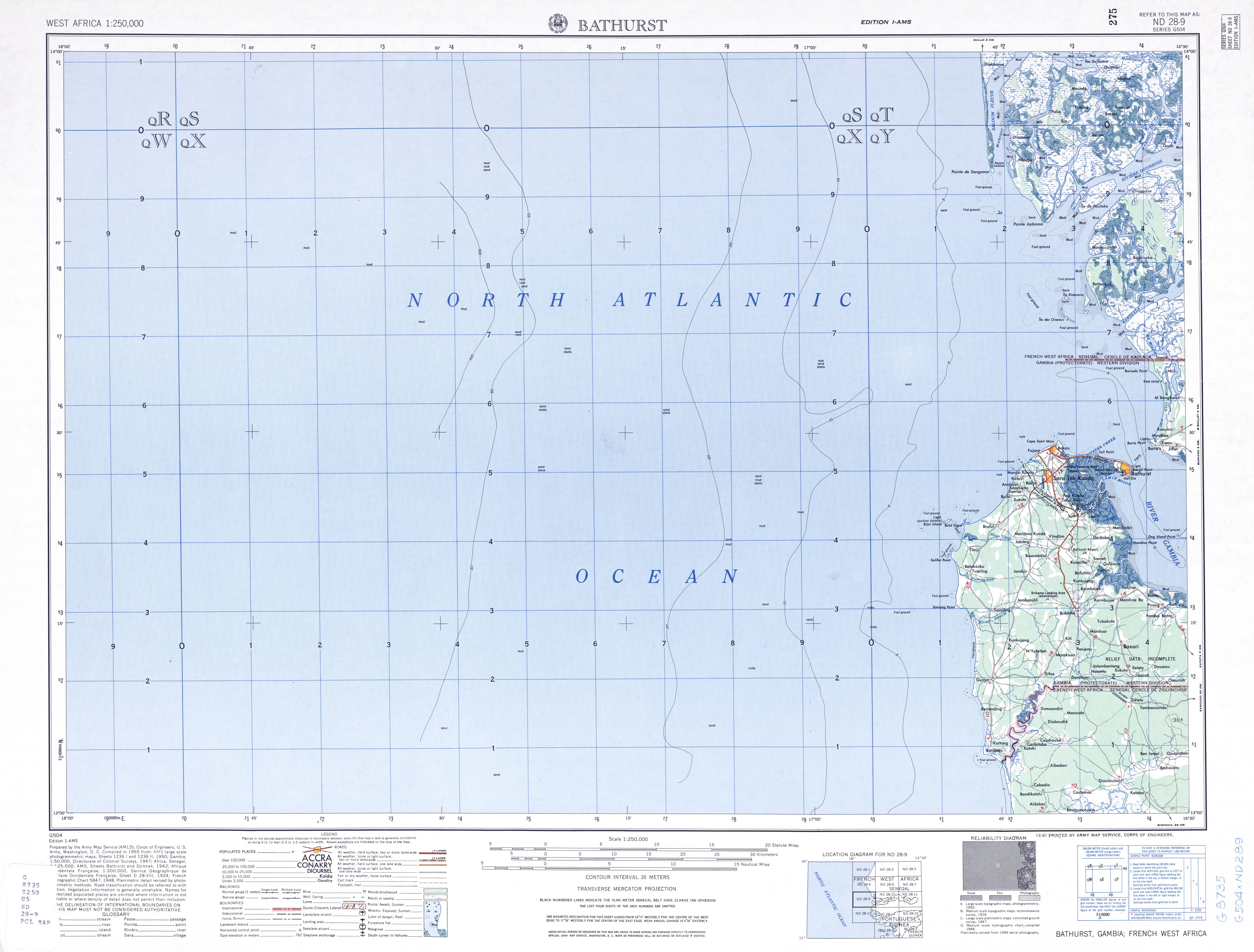
Bijol Islands ist eine Inselgruppe im westafrikanischen Staat Gambia.

Geographie

Die kleine unbewohnte Inselgruppe Bijol Islands im Atlantischen Ozean sind Gambias einzige Hochseeinseln. Die aus fünf Inseln bestehende Gruppe liegt ungefähr zweieinhalb bis dreieinhalb Kilometer vor der Küste bei Bald Cape nördlich der Ortschaft Tanji im Distrikt Kombo South. Sie bilden das westlichste Territorium Gambias. Die kleine Inselgruppe gehört mit zum 1993 eingerichteten Vogelschutzgebiet Tanji Bird Reserve, das auf dem Festland liegt und den Tanji-Fluss mit seinem Mangrovenwald am Ufer umfasst.

Die Inselgruppe ist der einzige bekannte Brutplatz von Raubseeschwalben (Sterna caspia), Königsseeschwalben (Sterna maxima) und Möwen (Laridae) in Gambia. Im Wasser sind Mittelmeer-Mönchsrobben (Monachus monachus), Kamerunflussdelfine (Sousa teuszii) und Schildkröten (Testudinata) zu finden.

Siehe auch

Literatur

  • Ilona Hupe: Gambia. Kleines Urlaubsparadies in Westafrika. 2., aktualisierte Auflage. Hupe Ilona Verlag, München 1999, ISBN 3-932084-19-5
  • Senegal & Gambia. Mit exakten Höhenlinien, Höhenschichten-Relief, GPS-tauglich, klassifiziertes Straßennetz, Gradnetz und Ortsindex. Reise Know-How Verlag Rump, Bielefeld 2004, ISBN 3-8317-7123-5 (Landkarte, 70 × 100 cm, 1:550.000)

Weblinks

  1. ifeq: nein|nein

|http://datazone.birdlife.org/site/factsheet/6351 |[http://datazone.birdlife.org/site/factsheet/6351 {{

  #if: nein
  |nein]
  |BirdLife International: {{#if: ||Important Bird Area Factsheet}}.]
  }}{{
  #if: 
  | Abgerufen am {{{Download}}}.
  }}

}}{{

  1. if: 6351 ||

}} Tanji River (Karinti) Bird Reserve] www.birdlife.org